
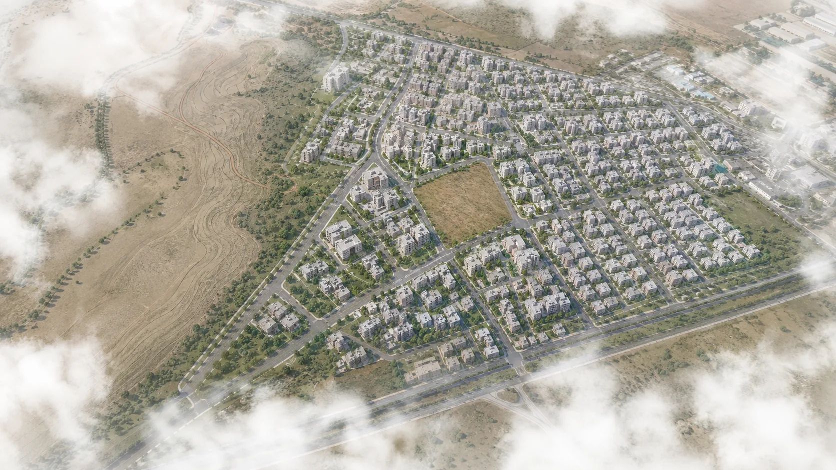
Plan Amendment1/1000 local plan posted · 07.05
Türkiye's land development platform
From one parcel,
to a buildable project.
We bring zoning, permit, sales and site data together on one platform. Analyse your parcel, watch the district, build scenarios and follow every change as it happens.
Example: Ankara, Gölbaşı, İncek · 1247 / 8
The data infrastructure behind land development in Türkiye
We continuously sweep zoning, permit, market and site data, then turn it into verifiable decisions at parcel level.
0provincesAll 81 provinces of Türkiye are covered
0districtsAutomated zoning query across all 973 districts
Permit, zoning, sales and location records, each one verified
Source verification · TimestampSpatial matching · Cross-check
Zoning, permit, sales, tender, risk and transport layers
Multi-layered data integrationContinuous, automated updates
Land development with ArkiFit, step by step
Run the whole process on one platformRead the guide
DiscoverRadar
Follow plan, permit and sales activity on one timeline; catch the rising district early.

81 provinces973 districts40,401 signals
AnalyseParcel Report
FREEEnter block and plot; zoning status, development rights and road frontage arrive with their source.
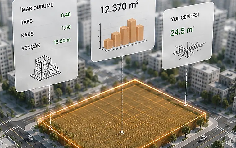
Cover 0.40FAR 1.5012,370 m²
DesignStudio
Draw the massing on real terrain levels; floor area, parking and floor plans compute as you go.
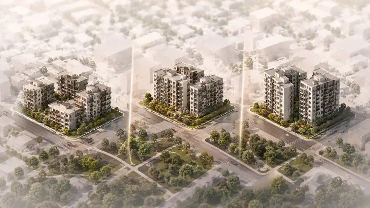
3D siteLive FARFloor plans
MonitorRadar
Set alerts for plan, permit and listing activity on the parcel and district you picked.
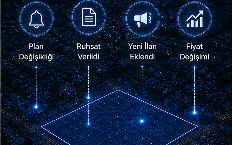
Live signalsSourcedAlerts
DecideArkiFit
Bring data, concept scheme and feasibility into one decision file and put it in front of stakeholders.

PDF reportFeasibilityDeck
Real outputs, real value
See every outputPreliminary Report
Zoning, ground, frontage and floor area on a single page.
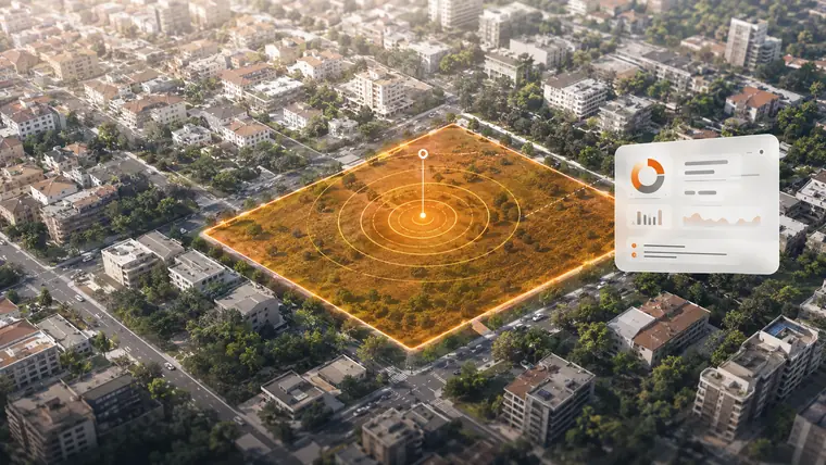
Zoning & Plan Data
Plan notes, development conditions and the official source behind them.
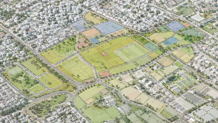
Studio Scenarios
Massing and layout alternatives for the same parcel, side by side.
Parking & Technical
Demand, capacity and code check, basement solution included.
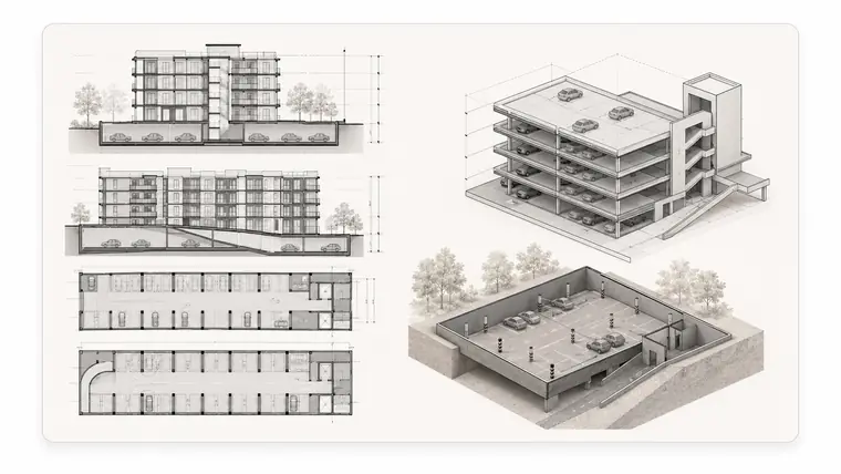
Sections & Elevations
Scaled sections, elevations and sheets; vector output ready to present.
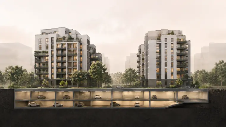
Radar Monitoring Screen
District signals, source attribution and timeline.

- One platform, the whole processEnd to end, from discovery to decision
- Verified, current dataEvery finding arrives with its source
- Automation that saves timeLess repetition, fewer mistakes
- Insight aimed at the decisionTurns data into action
01 ArkiFit Radar
Before you hunt for the right site, find the right district.
ArkiFit Radar brings zoning decisions, permit and project activity, house sales trends and development signals onto one screen. Read the district as a whole, spot opportunities early and base the investment decision on data.
- Development signals at neighbourhood and district scaleRead a district's potential through infrastructure, plan amendments, project and permit density.
- Plan, permit, tender and project timelineFollow every movement from the past to today on a single time axis.
- Comparable district filesPut districts side by side and weigh strengths, weaknesses and opportunities clearly.
- Smart reports and opportunity spottingSurface investable districts automatically, report them in one click and share with your team.
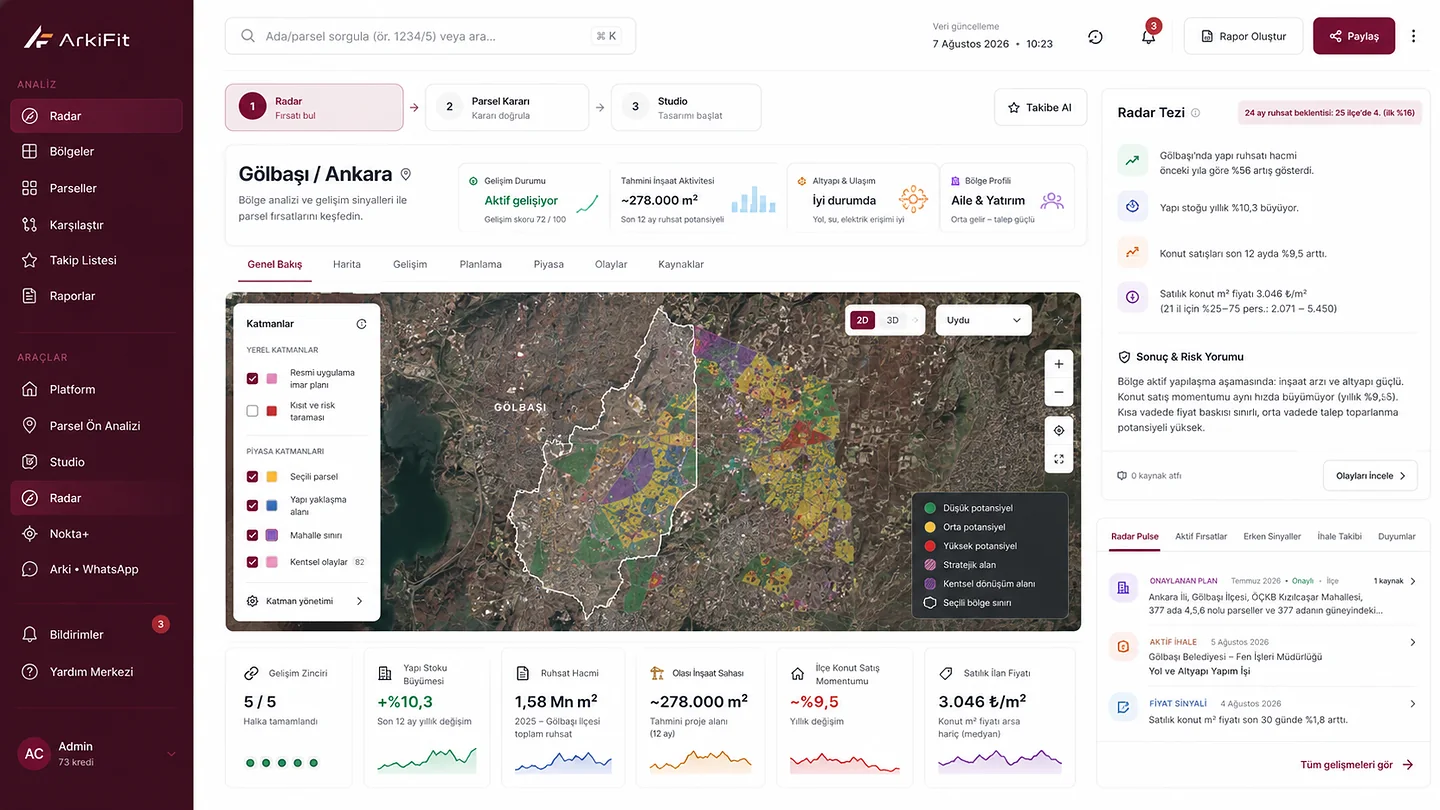
81Province coverageA data network spanning all of Türkiye
973District coverageDetailed district analysis at district scale
542Connected sourcesMunicipal, institutional and official publication feeds
40,401Verified signalsPlan, permit, tender and project events
CurrentLive data networkReal-time monitoring, development tracked as it happens
02 ArkiFit Studio
Turn parcel data into a living project.
Studio brings design on real terrain, area checking, feasibility, visualisation and presentation into one workspace. It runs in the browser and needs no installation.
Runs in the browserInstant access from wherever you are.
No installationIt stays current without your effort.
Real site dataWorks with current zoning and floor area rights.
2D + 3D workspacePlan it, see it, assess it.
3D site with topography
Real terrain levels, surrounding buildings and neighbouring parcels; multi-parcel and merger support.
Massing with live floor area
As you shape the parametric massing, used floor area, remaining rights and parking demand update instantly.
Floor plan editor
Edit the storeys the plan engine produces in a 2D editor; output honours real wall tolerances.
Landscape and parking
Landscape zones that sit on the terrain; parking that fills the bays inside the area you draw.
Sun and shadow analysis
Sun path by hour and season, shadow animation and the effect of neighbouring parcels.
AI rendering
Turn the massing into a photorealistic image in one click, with style and free-form direction.
Presentation studio
Slide-based editor and themes for a client-ready deck, plus full-screen presentation mode.
Professional export
PDF, PPTX, PNG, Excel; the 3D model as GLB and the concept scheme as DXF/CAD.
Built for architects, developers and real-estate professionals.Design faster. Decide more accurately. Present better.
WhatsApp Agent / Arki
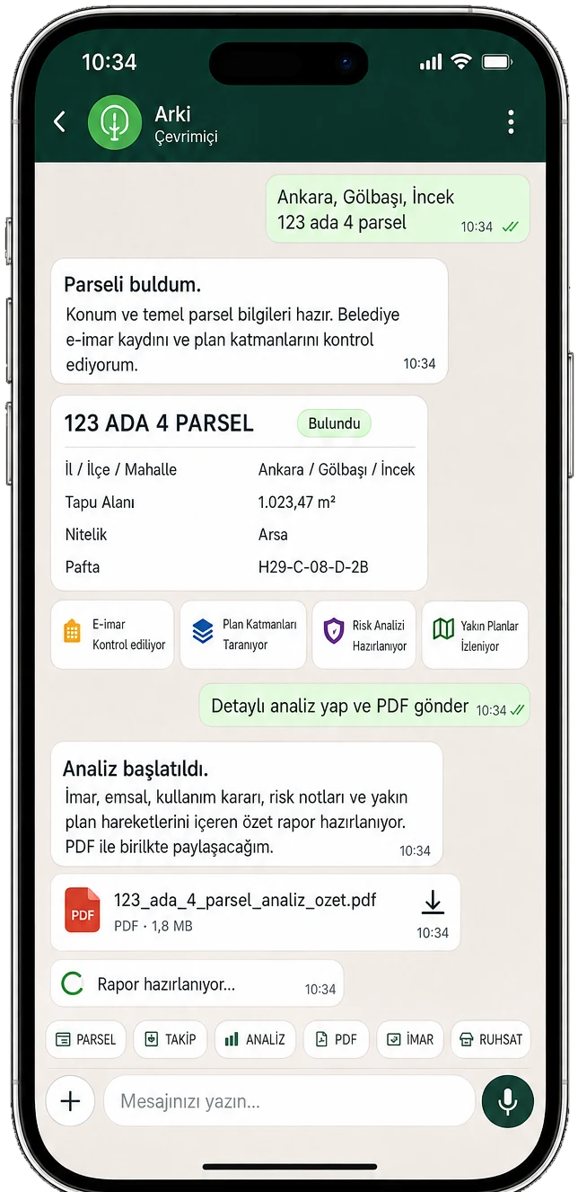
24/7 WhatsApp assistantStart parcel work by message
Send Arki a province, district, neighbourhood or block/plot. It finds the parcel, produces the zoning and capacity summary, watches regional risk and plan activity, and delivers the whole analysis to you as a PDF over WhatsApp.
- Free preliminary lookupSend block and plot; location and title data come back in seconds.
- Municipal zoning dataUse class, coverage, FAR and max height in integrated districts.
- Floor area and capacityBuildable area, approximate construction area and a storey scenario.
- “What if it were 5 storeys?”Change a parameter without spending a credit and see the result.
- Urban connectivity scoreAccess score to key destinations and the nearest ones listed.
- Full feasibility + PDFRun the credited full feasibility and get the PDF in the chat.
- Photorealistic renderTwo images of the proposed building for one credit.
- Watch a districtAutomatic alerts on new plan, permit and development events.
- Account, credits and historyLink your number with a code; all your work in one place.
- Ask in natural languageWrite freely; answers come from the tools, never invented.

DATA BACKBONE
Not a product. Infrastructure.
Every ArkiFit product feeds from the same data backbone. Official series, public notices, local decisions and satellite measurements are collected on a single data line, verified and stored with their source.
Source Content Coverage Update Status
TurkStat building permitsm² and use-class breakdown81 provincesQuarterlyActive
TurkStat house salesSale counts at district level81 provincesMonthlyActive
Cadastral parcel dataParcel geometry and neighbourhood catalogue81 provincesOn lookupActive
Official Gazette · ministry postingsPlan approvals and public display noticesNationalDailyActive
Municipal council decisionsZoning agendas and decision texts973 districts sweptDailyActive
e-EIA project noticesEnvironmental impact applicationsNationalDailyActive
TOKİ · public investment programmePublic projects and investment linesNationalPeriodicActive
Public procurement · construction tendersLeading tender signalNationalDailyActive
Satellite building footprintsBuilt-up density and saturation measurementNationalPer releaseActive
Land listing comparables₺/m² market anchor30 metropolitan citiesDailyActive
Every source passes quality and consistency checks.Reliable data is the ground of a sound decision.
FREQUENTLY ASKED
Short answers.
From floor area calculations to data sources, a summary of what people ask most. The full set lives on the FAQ page.
See all questions ↗What is ArkiFit?+
ArkiFit is three connected surfaces: the free Parcel Report gives a fast zoning and preliminary feasibility summary for a single site; Studio turns that same site into a 3D site design and concept scheme; Radar combines plan, permit, market and development signals at neighbourhood and district scale.
What is the difference between the free lookup and Studio?+
The Parcel Report is the free entry product: it shows a site's zoning status, development rights and a preliminary estimate summary with no sign-up and no card. Studio is the project product, used for saving the scene, 3D site design, editing massing and floor plans, AI rendering, presentation and professional export.
What does the Arki WhatsApp assistant do?+
Arki is ArkiFit's parcel assistant on WhatsApp. Send the province, district, neighbourhood and block/plot and it runs a free preliminary lookup; once your account is linked, the credited detailed analysis, capacity figures and PDF report all run in the same conversation.
What outputs does a parcel lookup produce?+
Parcel summary, zoning rights, area schedules, floor area check, development potential, storey distribution, unit estimate, parking demand, approximate cost, quantities, 2D plans, a 3D view and a PDF preliminary estimate report. The report contents can be selected and edited.
Does ArkiFit calculate floor area rights automatically?+
Yes. From the zoning conditions you enter or that are fetched, it computes the floor area right, usable construction area and development potential, and continuously checks the floor area used in the scenario. It can also generate alternative scenarios that use the allowance most efficiently.
Where does Radar's data come from?+
TurkStat building permit and house sales series, official cadastral data, Official Gazette and ministry display notices, municipal council decisions, e-EIA, TOKİ and public investment programme announcements, public construction tenders, satellite building footprints and land listing comparables. Every record is stored with its source and date.
Do the results replace official zoning status?+
No. ArkiFit outputs are for preliminary assessment; the relevant municipality is authoritative for official zoning status. That limit is stated at the foot of every report, and none of it is investment advice.
THE DATA INFRASTRUCTURE OF LAND DEVELOPMENT